Search our Places Database
Rib Mountain, Township of
Return To List of Locations | Back to Search
For more information on this location, please contact our research library.
Author:
Mary Moltzan
Location:
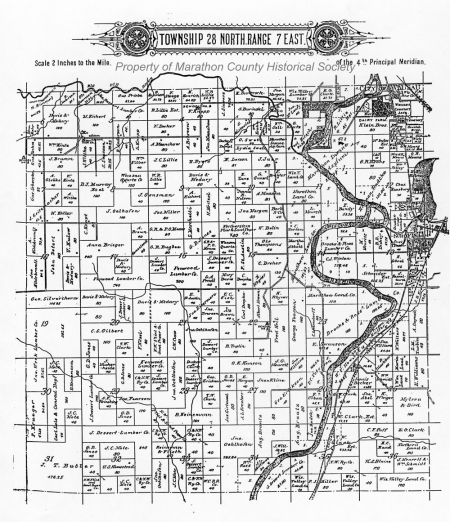
T. 28 N. - R. 7 E., west of Wisconsin River
Founded:
January 6, 1905
Formallized:
1931
Background:
Population: 1905-412, 2000-7,566.
Originally part of Weston Township, the township was separated in 1905, called Erickson Township, and renamed Flieth Township. It became Rib Mountain in 1930.
Many of the first settlers were Germans who purchased land "on paper" and came to claim it. Some left, but those who stayed cut down trees and built shacks or log houses. They cut down more trees, some to be burned and some to be logged and floated down the Wisconsin River to mills farther south. Men from the township were still riding logs to the Rothschild Paper Mill when it was built around the turn of the century. More settlers arrived, more land was cleared, and farming was done on a small scale.
When the first settlers came, Rib Mountain was isolated from Wausau by the Wisconsin and Rib rivers. Some of the older residents remember the first bridge across the Rib River that connected Rib Mountain and Wausau. Over 100 feet long and built of steel, it was named McCleary Bridge after a man who lived in a little pink house near the east end of the bridge. After the Rothschild Dam was built in 1909, residents of the area could walk across the dam from one side of the river to the other. Cow paths, wagon trails and logging trails were the first roads in the township.
First Public Official:
George Erickson
Biography:
Erickson was active in township government. He was a supervisor of Weston Township as far back as 1892; appointed Township Chairman in 1901; elected assessor in 1904; elected Township Chairman in 1905. Erickson was chairman from 1905 to 1936 with the exception of 1924 - 26.
For a time the township was named Erickson in honor of him.
About The Post Office:
No P. O.s were ever opened in the township.
Churches:
1. Bethlehem Lutheran Church - First church in the township. Originally a school, it was located in Section 8 and built in 1890. It was purchased by the Lutheran Missouri Synod in 1900 as a mission church.
2. The Jehovah's Witnesses, then known as Bible Students, met in private homes and rented halls in around 1900.
3. The Seventh Day Adventist Church was organized in 1898 with services in members' homes and various halls.
Schools:
See also Weston Township
1. The first known school was built of logs at an unknown location.
2. The next school on record was built in 1890 on land donated by Julius Wittke in Section 8. It was known as District School #3. See Bethlehem Lutheran Church under churches.
3. In 1900, District #6 school was built on the Flieth-Marathon Township line in Section 7. Later it was named the Woodlawn School and moved two miles west. It was closed in 1963-64.
4. A brick school was built in 1905 and named the Mosinee Hill School. Located in Section 22, it was closed in 1955.
5. Mountainside School was located on the east side of N. Mountain Road in Section 4. It was demolished by a tornado in 1935.
6. Roosevelt School, named after President Theodore Roosevelt, was located on Flieth St. It was closed in 1941.
Business:
Rib Mountain was made a state park in 1922. Forty acres of land were donated by the heirs of Jacob Gensmann and another 120 acres were purchased by the Kiwanis Club of Wausau and turned over to the state. The road was officially dedicated on September 13, 1934. During the depression, the Civilian Conservation Corps created a parking lot from a swamp at the park and built shelters as well as toboggan, ski and bobsled slides. The development of the ski area began in 1936.
Industry:
1. Logging
2. Sawmills : Anchor Sawmill owned by Melchor Eichert. Other names of sawmill owners: Bremer and Sullivan; Buchberger; A. Prott and Zochert who had a mill on Black Creek in the southern part of the township.
3. Quartz was mined from the west side of Rib Mountain as early as 1893.
Farming:
See Background
Stories:
Running almost straight east and west, the McCleary Bridge was high above the water to allow for high water from melting snow each spring. This height made it necessary to have steep inclines on either end of the bridge. In winter, farmers with a team and a load of wood sometimes found it impossible to get up the incline, so they drove over the ice of the river instead. Spring and summer brought problems also. One resident said the spring floods caused long muddy stretches along the road next to the bridge, so people took a boat across the river. In summer, the bridge was so narrow a person could have trouble getting a load of hay across. One man, sitting on top of a load of hay, got stranded on the trestle of the bridge.


OUR HISTORY ONLINE
- Search All Records
- Search Cities, Towns and Villiages
- Search Marathon County Address Changes
- Browse Census Records
- Browse City Directory Records
- Browse Military Records
- Browse Local History Publication Records
- Browse Biographies
- Browse High School Yearbooks
- View A List Of Our Online Records
- Other Resources
HELP US GROW OUR DIGITAL CONTENT.
DONATE TODAY!
https://www.paypal.com/cgi-bin/webscr?cmd=_s-xclick&hosted_button_id=VP4...